Google Maps Geocoding GUI
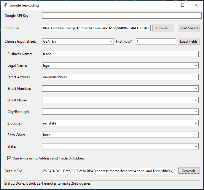
Using Google Maps API saved us hundreds of hours of manual address typo fixes in Quarterly Census of Employment and Wages (QCEW). Having implemented the address checks in Python, I decided to enable my team to use Google Maps API by developing a GUI application that loads an excel file, geocodes addresses, and returns the output.
Summary
Basically, it is a Python tkinter GUI to geocode addresses or business-name-address combinations using Google Maps API.
The user needs to provide their own Google Maps API key. The current version reads an excel file and outputs another excel file. You can choose the business name, address, city, zipcode, … fields.
Since Google API is not free, and API queries are not fast, I use this program to geocode addresses when the addresses are not found in other systems, like NYC GBAT, because of typos and changed addresses.
Another advantage of this program is that it can search for business names in Google Maps.
Possible improvements:
(1) Some of the errors/exceptions haven’t been workout yet.
Example: If the user chooses a date, say two years from now, Google throws an error and program stops.
(2) Multithreading the tasks will keep the application responsive when the API queries run. However, this reformatting the program into a python class … I’ll know better next time.
More details to be added…
Also, check out my Google Transit GUI.